Have you ever been curious as to where some of the steamboat landings were along the Ouachita river? Back in 1976, the Ouachita Council of Governments and the Monroe-Ouachita Regional Planning Commission did a two year Resource Survey study of Historic Preservation in Ouachita Parish. They were given a funding grant from the Housing and Urban Development Department. The plates in the two books are fascinating! The first plate I want to share is a map showing the landings and ferries that were all up and down the Ouachita!
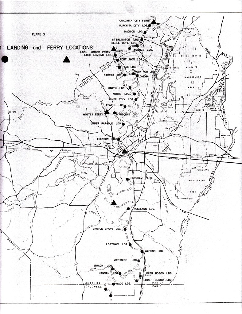
The triangles are the ferry spots and the circles are the steamboat landings. This shows just how important steamboats were in their day!

Leave a comment